最新版 MAPublisher 11.4 更新於 2024/7/30
最新版 Geographic Imager v6.8 更新於 2024/5/15
支持 Adobe Illustrator 2024 (64-bit)

MAPublisher 繪圖軟體無縫集成了超過50個GIS 製圖工具到Adobe Illustrator環境中,幫助你創建你想要的地圖。導入被廣泛使用的GIS數據格式,包括來自Esri, MapInfo, FME Desktop, AutoCAD, Google 和美國政府。將數據導出到各種標準的GIS格式,包括將文檔輸出成地理空間的PDF和將之移動到移動設備PDF Maps iOS app的能力。所有的GIS數據的屬性以及地理參數皆可被維護與編輯。使用MAPublisher工具來創建、查詢及選擇功能與屬性。
MAPublisher 支持 Esri ArcGIS 10地理數據庫和ArcMap文檔(MXD),輕鬆連結到個人、檔案和ArcSDE地理數據庫。現在運用 MAPublisher 製圖比過去任何時候更快更方便。當與 Adobe Photoshop 的地理成像儀(Geographic Imager)一起使用時,它們形成了完美搭配。


Seamless integration with Adobe Illustrator
MAPublisher panels seamlessly integrate into the user interface and can be resized, moved, and docked just like native Adobe Illustrator panels. The MAPublisher Toolbar allows you to easily launch all the main MAPublisher tools in a single click. Tools are organized to better suit your cartographic workflow.
Import and map geospatial data
Import GIS data formats from ArcGIS, MapInfo, FME Desktop, AutoCAD, Google and other industry-leading formats. Connect to WMS and WFS map services to import data. Make vector and attribute edits and export MAP Views and MAP layers to a variety of GIS data formats. Export the entire document to a georeferenced image including exporting to web tiles in MapBox and Tile Map Service formats.
View and edit data attributes openly
The attribute table holds map attribute information your vector line, area or point data. Add and remove columns, edit schemas, join tables and apply expressions to customize map attributes. Pin attributes to keep current even if artwork is not selected and navigate them using recordset navigation tools. A MAP Data Snapshot panel keeps attributes visible even after data is deselected for easy comparison. An Image data type that supports images imported from Avenza Maps and exported to Google Earth.
Jump start your map creation with Vector Basemaps
This exciting tool gives you the ability to import georeferenced vector data to your maps from an online server. Imported data is autostyled based on the zoom level and attribute information, but can also be configured or imported by users to create savable custom styles.
Connect to spatial databases
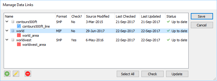
Spatial Databases are now included as a standard feature. Directly import feature classes from Esri Personal geodatabase (.mdb), File geodatabase (.gdb ) PostGIS, and ArcSDE servers. Use SQL queries and spatial filters to refine import. ArcGIS 10 geodatabases and ArcMap documents are supported. Basic geodatabase import functionality is available for Mac. Basic personal and file geodatabase import also available, with certain limitations.
ArcGIS Online integration
Sign-in and import Feature Layers, Map Image Layers, Tile Layers, and web services from ArcGIS Online with full attributes and spatial referencing. Geocode addresses with ArcGIS Online using MAP Point Plotter.
Get further with MAPublisher FME Auto add-on
MAPublisher® FME Auto™ provides the ability to import FME FFS files. It also installs as an FME writer to translate GIS data from FME Desktop to Adobe Illustrator. MAPublisher FME Auto license required, purchased separately.
Create fresh styles with MAP Themes
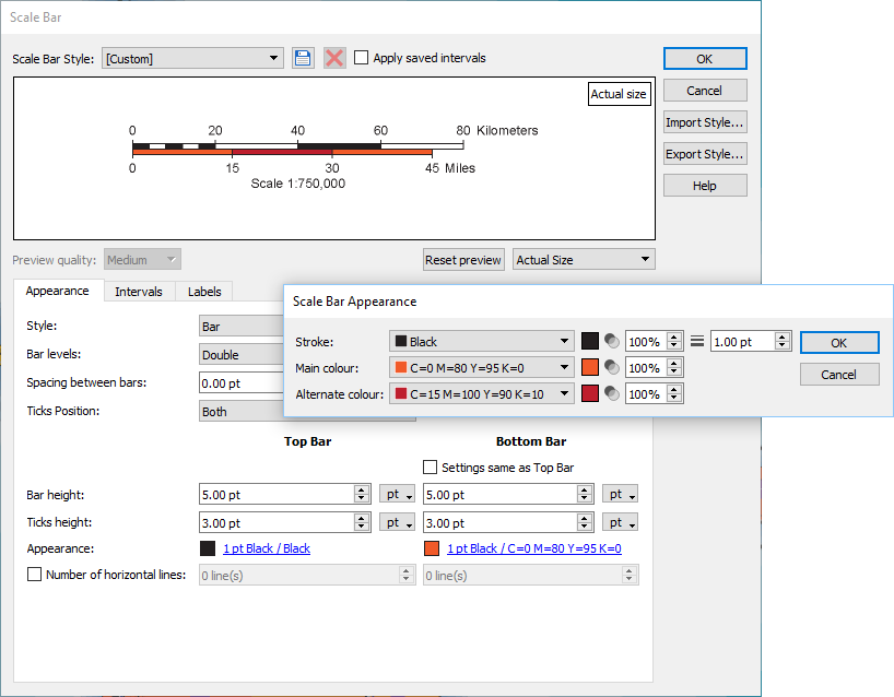
Use MAP Themes to create dot density maps, charts and stylesheets for visually stunning thematic maps. Use classification methods to easily create data classes. In addition, create highly customizable MAP Theme Legends that automatically update and add other map elements including scale bars and north arrows with preset designs or edit existing ones.
Go mobile with Avenza Maps and the Avenza Map Store
Create map packages from your documents that are compatible with the Avenza Maps app for iOS, Android, and Windows. Map packages are pre-processed specifically for the Avenza Maps app. Avenza Maps vendors can upload map packages to the Avenza Map Store from within Adobe Illustrator and have them for sale very quickly.
Full geospatial PDF support
Create Adobe Acrobat geospatial PDF files containing coordinate system and attribute data from any MAPublisher document. Find locations, measure distances, perimeters, and areas, add locations markers and customize export settings. Also, import geospatial PDF and GeoPDF® documents and automatically assign the data to MAPublisher layers.
Quickly geoprocess features
Buffer, join, spline, flip, crop, and simplify map features at the click of a button. Join Areas to dissolve multiple features into a larger feature and still retain attributes. Use the Area Plotter and Line Plotter tools to plot coordinates and draw features.
Select data with fewer clicks
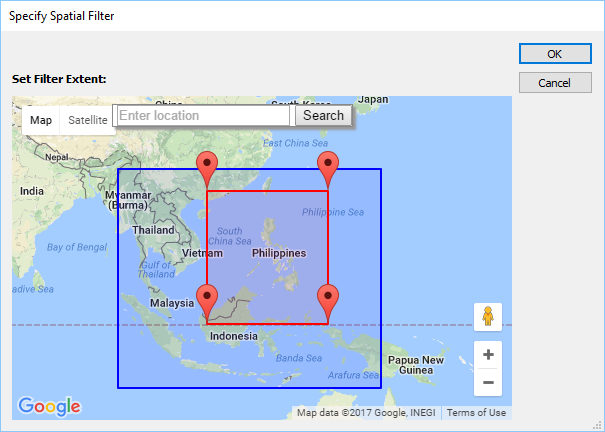
MAP Selections let you to build, edit, and apply multiple selection criteria based on the attributes and properties contained in MAP Layers. Create Spatial filters to select data based on intersection or containment. Selection criteria are created in an expression builder and can be applied to any MAP layer and. Saved MAP Selections can be applied to new or existing selections.
Label like a pro
Create labels for map objects using values from the MAP Attributes panel. Use the Label Features tool to add labels to layers automatically; and MAP Tagger and Contour Tagger Tools to apply labels individually. Achieve advanced labelling with MAPublisher LabelPro™. More rules, styles and sophisticated labelling engine results in more efficient and better placed labels.
More flexibility with MAPublisher utilities
Text Utilities performs many text actions such as correcting upside down text, separating multiline text into single line, and cropping text path to text length. Use Path Utilities to perform path operations on lines and areas. Add detail, copy vertices to a point layer, find self intersection points, remove duplicate points, and convert beziers to polylines. Convert compounds to groups and create an elevation plot based on features.
Georeference intuitively
Georeference data with the help of MAP Locations. Give spatial properties to a non-referenced map by establishing a relationship between page locations in the document (using MAP Page Locations) and world locations. Use online map services to quickly find world coordinates to use in georeferencing. Plot MAP Locations anywhere on your maps. They can be used as annotations to identify map world or map page locations and in other MAPublisher tools such as Specify Anchors, Area Plotter, Line Plotter, Point Plotter, and the Georeferencer.
Make web maps without extensive coding experience
Export Adobe Illustrator documents with GIS data to interactive HTML5 maps. Web maps complete with callouts, rollovers, layers, pan and zoom controls, and with all the underlying GIS attributes intact. Export maps without any additional coding or software requirements and embed them to any web page.
Plot and geocode points
Plot points based on coordinates or address. Address points can be plotted using the MapQuest or Esri geocode engine. Use Find Places to dynamically search for points of interest and add them to your map. Works great to quickly create a point dataset for any project.
Map better with better cartographic tools
Create Knockouts automatically generates masks behind text to hide underlying lines and enhance map readability. Great for contour labels and road labels. The Create Halo tool produces halo graphic styles and applies halos to area, line, point and text features.
A better way to crop data
Crop map documents only to the area of interest. Easily remove unwanted data while preserving attributes and styles. Perfect for creating inset maps. New Crop to Shape function allows you to crop to any shape.
Detailed grid, graticule and index customization
Redesigned to easily create map grids and map indexes. More controls and ability to create multiple grids will provide highly customized looks. Graticules can be created for reference purposes or to follow designated lines such as latitude and longitude and can also be labelled for indexing. When a labeled grid has been established, MAPublisher is able to generate index files, containing the location of text objects in MAP Layers.
Map faster with automation
Use Automation to configure settings that intiate MAPublisher operations upon data import to automate map production, such as manage MAP Views, apply MAP Theme stylesheets, create grids and graticules, label using MAP LabelPro, and export to geospatial PDF. Use in conjuction with MAPubilsher FME Auto for a fully automated cartographic workflow.
Simple license management configuration
Easily manage license options including commercial, academic, multi-user and floating. Empower multiple users on a network with cost-effective network or floating licenses.
MAPublisher just works
The latest release of MAPublisher is available for Windows 10 and Windows 11, and for macOS 12, macOS 13, and macOS 14. MAPublisher 11.4 is fully compatible with Adobe Illustrator 2023 and 2024.
System Requirements
Before installing MAPublisher, please ensure that these minimum system requirements are met (recommended requirements are mentioned as necessary):
Windows
- Adobe Illustrator 2023 (27.x) / 2024 (28.x) (64-bit)
- 1 GHz or faster (multi-core processor recommended)
- Windows 10 and Windows 11 (64-bit)
- 4 GB RAM (8 GB RAM or higher recommended)
- 1 GB of available hard-disk space
- Display resolution of 1280 by 800 pixels
Please note that MAPublisher 11.4 was tested on Adobe Illustrator 27.9 and Adobe Illustrator 28.0.
Adobe Illustrator 2023 (64-bit) is deprecated in MAPublisher 11.4.
Adobe Illustrator 32-bit is no longer supported.
macOS
- Adobe Illustrator 2023 (27.x) / 2024 (28.x)
- Multi-core Intel or Apple Silicon processor
- macOS 13.0 /14.0
- 4 GB RAM minimum (8 GB RAM or higher recommended)
- 1 GB of available hard-disk space
- Display resolution of 1280 by 800 pixels
Adobe Illustrator 2023 is deprecated in MAPublisher 11.4. Update Adobe Illustrator to continue using the latest MAPublisher release.
macOS Monterey (12.x) is no longer supported.
Additional Notes
Not all foreign language versions of Adobe Illustrator may be supported. Contact [email protected] for more information.
Installing MAPublisher on a system that does not meet the minimum requirements may produce unexpected results or errors. These issues may not be supported by Avenza Technical Support.
Memory Recommendations
Occasional Users
A minimum of 4 GB RAM is required. A graphics or GIS user who uses MAPublisher with medium-sized data sets with up to 20 layers, minimal text labels, and some low-resolution or small coverage raster images.
Power Users
The recommended memory for a power user is 8 GB RAM or more. A professional cartographer who uses MAPublisher daily and works with large urban data sets (including large transportation layers) with 20 or more layers, raster-based air photographs, large numbers of text labels, complex fill patterns, etc.
Memory Usage
Users often ask us why so much RAM is needed to operate MAPublisher. First of all, Adobe Illustrator requires a significant amount of RAM itself in order to run smoothly. Secondly, map data sets are often large which increases the need for RAM even further. Map data sets contain both vector and attribute data which must be stored in memory. Since we are adding a database to Adobe Illustrator this increases the file size, which increases the RAM requirements. MAPublisher builds a mini-GIS application inside Adobe Illustrator so that it can geocode information and attach data to objects. This also has some overhead.
GIS users also often ask why so much more memory is needed with MAPublisher than is with GIS software. The graphics environment software of Adobe Illustrator loads the entire file into memory rather than just reading it from disk, thus more RAM memory is required.
When you are importing a large number of files into Adobe Illustrator using MAPublisher, you’ll notice that the amount of available memory will decrease rapidly and your computer loses speed. This is due to memory management. MAPublisher reserves a fairly large amount of memory for each import action, which is not properly returned when the import is done or even when it is canceled. The solution is simple: save your file, close it, and open it again. It’s not even necessary to close Adobe Illustrator itself. By closing the file, the reserved memory is properly returned.
Memory Saving Tips
- Since a percentage of the memory is taken for attribute storage, remove any redundant or otherwise unnecessary attribute fields from the MAP Attributes table of a layer.
- Many sources of street data include paths/vectors that are segmented based on street addressing information. You can use the MAPublisher Join Lines function to join these into single linear features based on a selected attribute field. Reducing the number of objects (and data records) in the map file will free up memory.
- Many GIS data files are large and when a series of such files are imported, you may find that the import function starts to run more slowly. This is because scratch and memory allocations are being used up. The best solution is to periodically save your work, quit Adobe Illustrator, and then restart. This will free up the available scratch memory.
- Reduce the minimum number of Undo commands (since they all reside in memory).
- Use polyline or pre-joined linear feature datasets where available.
- In your GIS application, strip out the attributes you won’t be using for queries or labeling before importing the data into Adobe Illustrator.
- You can set a primary and secondary scratch disk under the Adobe Illustrator preferences option in order to draw additional storage from a partitioned or multi-drive environment.
- Turn off the layer preview icon that appears to the left of each layer name in the Adobe Illustrator layers panel. This can be done by clicking the options menu in the layers panel and then selecting small panel rows in the panel option dialog box.
MAPublisher LabelPro
Label like a Pro
The MAPublisher® LabelPro™ add-on offers advanced labeling capabilities beyond those available in the standard MAPublisher Feature Text Label and the MAP Tagger Tool, including a sophisticated and user-friendly rule-based and collision-free placement engine.
MAPublisher FME Auto
Automate workflows from FME Desktop to MAPublisher
MAPublisher® FME Auto™ is a powerful add-on that connects the GIS data processing environment of FME® Desktop to the cartographic design and publishing environment of MAPublisher and Adobe® Illustrator® (Windows only).
Geographic Imager for Adobe Photoshop
Working With Geospatial Imagery Doesn’t Have to be Complicated
Geographic Imager® mapping software enhances Adobe Photoshop to make working with spatial imagery quick and efficient. It adds tools to import, edit, manipulate and export geospatial images such as aerial and satellite imagery.
Enjoy the use of native Adobe Photoshop functions such as transparencies, filters, pixel editing, and image adjustments like brightness, contrast, and curve controls while maintaining spatial referencing.
